The following routes, arranged from easiest to most challenging, are a sample of the routes we generally ride. Whether your new to the team or just new to the area, we hope you'll take advantage of the routes posted here to find your bearings. If you'd rather go with a friend, join our GroupMe (go to a meeting to get added)! Members of the team are always posting rides, and we encourage others to post rides as well.
Easy Rides
In-N-Out Ride

Distance: 9.60 mi. -- Total Elevation Gain: 317 ft.
Cat Oaks Loop

Distance: 16.41 mi. -- Total Elevation Gain: 572 ft.
Moderate Rides
Smoothie Ride

Distance: 22.20 mi. -- Total Elevation Gain: 1126 ft.
Coffee Ride

Distance: 20.83 mi. -- Total Elevation Gain: 593 ft.
The “Echelon” Route
Note: ‘Echelon’ is a fast-paced group ride that leaves from Vieja Valley Elementary at 8:30 AM on Saturdays.

Distance: 31.32 mi. -- Total Elevation Gain: 1562 ft.
Old San Marcos

Distance: 19.00 mi. -- Total Elevation Gain: 1669 ft.
Challenging Rides
Cold Springs Tavern

Distance: 30.76 mi. -- Total Elevation Gain: 3687 ft.
Ventura Ride

Distance: 74.92 mi. -- Total Elevation Gain: 1954 ft.
The Ridge (Gibraltar Road)

Distance: 40.18 mi. -- Total Elevation Gain: 4895 ft.
Solvang Loop
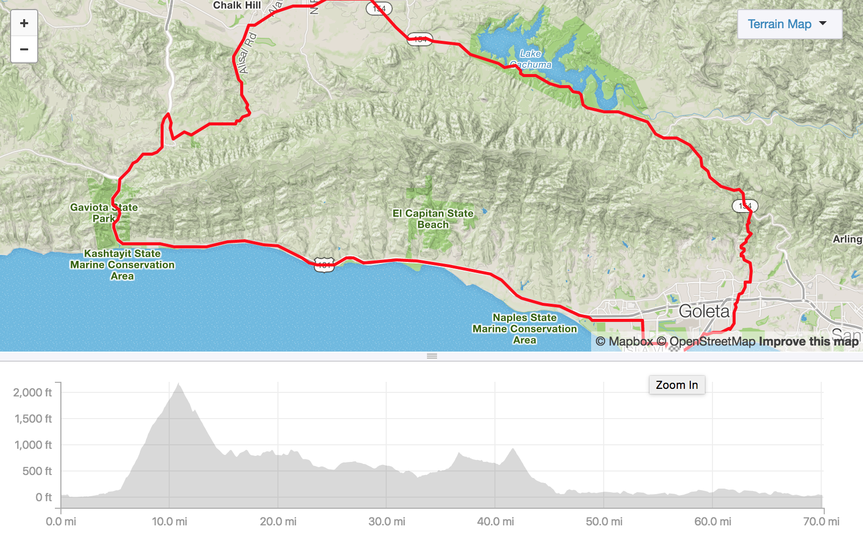
Distance: 70.26mi. -- Total Elevation Gain: 4915 ft.